

Ipsilum: The New Generation of Geospatial Intelligence
Cloud-based and powered by artificial intelligence, Ipsilum turns maps and data into immediate, intelligent, and accessible decisions for all types of users.


Who We Are
For over 20 years, we have managed geospatial information and turned that expertise into a platform everyone can use. Ipsilum. No complexity. No technical barriers. Just results: analysis, decisions, and advanced management — directly from the cloud.
About usMission
To brings our knowledge accessible to any organization, without requiring technical skills or complex tools.
Vision
To become the leading cloud platform for those who manage, analyze, or act upon geospatial information. A simple, powerful, and intuitive environment that transforms how location-based decisions are made.
Purpose
To put the power of geospatial intelligence in everyone’s hands. To democratize access to capabilities that were once exclusive to experts and turn technology into a true enabler of change.
Technology
Ipsilum enables the management, analysis, and visualization of location-based information from a single modular platform. It is made up of several interconnected modules, each with a specific function and an interface tailored to different user profiles.
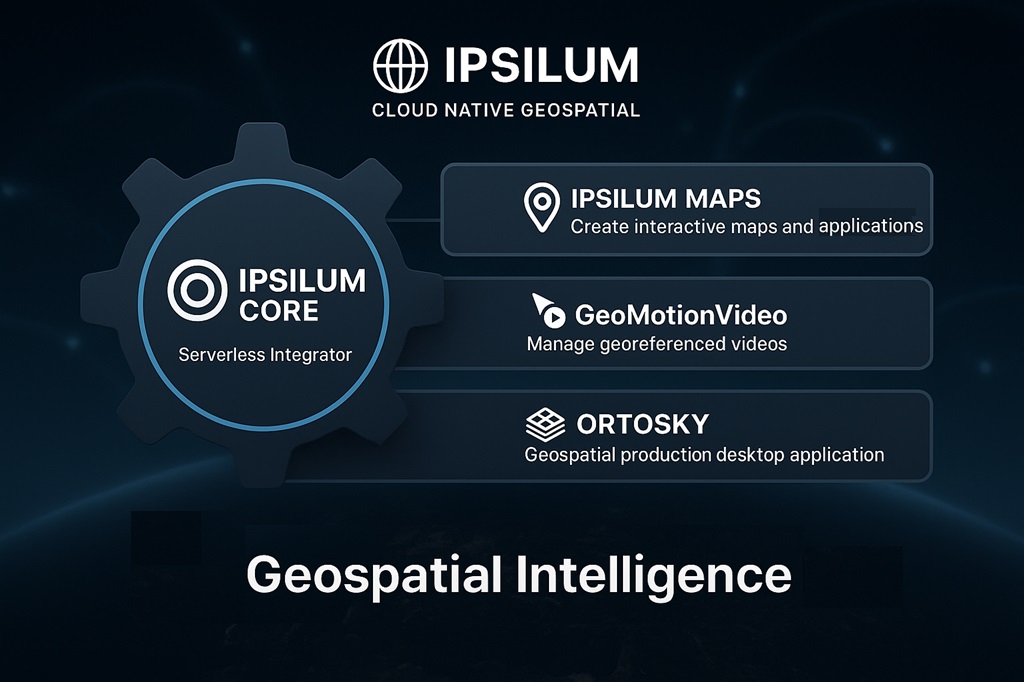

Ipsilum Core
is the engine that powers and connects everything in the platform. It has no user interface, but it is the most powerful component. Acting as the brain of the system:
– Orchestrates process execution
– Integrates real-time data (from IoT, APIs, sensors)
– Automates workflows
– Enables advanced geospatial analysis directly in the browser.

Ipsilum Maps
is the main interface for creating maps, dashboards, and analyses.
It is the most visible part of Ipsilum. From here, users can configure powerfull interactive geospatial aplications, control panels, and custom processes.
Designed for business users, technologists, and analysts — only basic GIS knowledge is needed to get started.
Use cases:
– Real-time data visualization
– Operational maps and dashboards
– Custom process definition directly from the browser

GeoMotionVideo
combines video and geolocation to monitor, record, and analyze activities.
This module is designed to integrate synchronized georeferenced video (from drones, patrols, mobile devices), and support visual-spatial analysis of routes, events, or inspections.
Everything runs on a simple interface powered by Ipsilum Core.
Use cases:
– Field patrol and unit tracking
– Visual inspections and post-incident analysis
– Dual view: synchronized map + video

OrtoSky
handles local processing of complex geospatial data.
It is the only desktop component of the platform, designed for intensive tasks such as processing photogrammetric data, LiDAR, or 3D models. It integrates with Ipsilum Core, allowing automatic synchronization of locally processed data with the platform’s cloud workflows.
Use cases:
– Photogrammetric restitution from aerial or drone stereoscopic image pairs
– Generation of vector data and quality control
– Manual refinement of LiDAR datasets
Ipsilum applies geospatial intelligence where it delivers the highest impact.
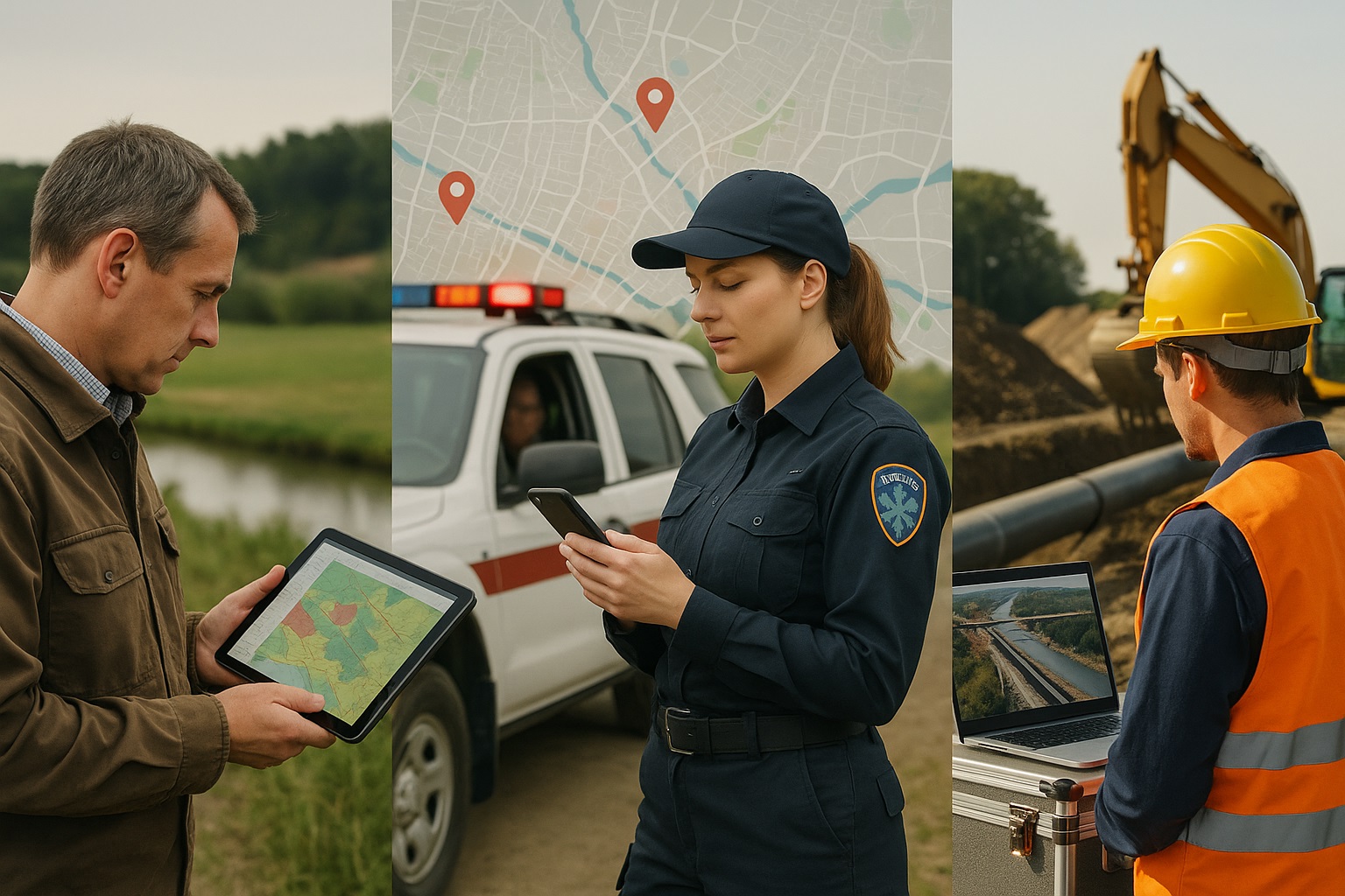
Ipsilum is a flexible and robust technology platform capable of adapting to many different fields. However, to maximize real-world impact, we have chosen to focus on sectors where geospatial intelligence provides the most added value.
These sectors — such as territorial management, emergency response, and infrastructure monitoring — are often burdened by fragmented data, complex tools, and slow decision-making processes. Ipsilum transforms that reality by:
– Automating data collection and processing
– Enabling real-time, location-based decision-making
– Making advanced technologies accessible to non-experts
– Creating a unified and visual environment for planning action and analysis
By focusing on high-impact domains, we help organizations reduce complexity, improve coordination, and unlock the full potential of their geospatial data.
Ipsilum enhances crisis management by connecting institutions and users through real-time, geolocated coordination
🔄 Direct communication with users and institutional coordination
Ipsilum introduces a unique two-way comunication: in addition coordinating emergency services during disasters, it allows real-time input from affected populations — enabling contextual, geolocated responses.
✅ What does Ipsilum solve?
– Builds public trust and confidence during crisis management
– Real-time data collection from mobile devices of affected population
– Active, two-way communication with affected communities before, during, and after disasters
– Unified operational picture for security, emergency, and logistics teams
– Radically improves inter-agency coordination and decision-making
💡 Use cases:
– Smart alerts based on location and emergency type
– Dynamic incident maps submitted by the affected population
– On-the-ground tracking of resources (ambulances, patrols, shelters, etc.)

Ipsilum simplifies the monitoring and management of large-scale infrastructure through real-time, geospatial intelligence.
📡 Real-time monitoring of remote work, assets, and distributed operations
Infrastructures such as mining, pipelines, power lines, or roads require platforms capable of monitoring, planning, and managing elements over long distances. Ipsilum delivers exactly that — in a cloud-based, visual, and interoperable environment.
✅ What does Ipsilum solve?
– Monitoring of linear work with progress control by segment
– Management of distributed assets with georeferenced information
– Field incident detection via mobile devices or remote sensors
– Visualization and traceability of the full infrastructure lifecycle
💡 Use cases:
– Periodic inspections and alerts on critical segments
– Real-time monitoring of roadwork or power line operations
– Integration with IoT sensors and geolocated field reports

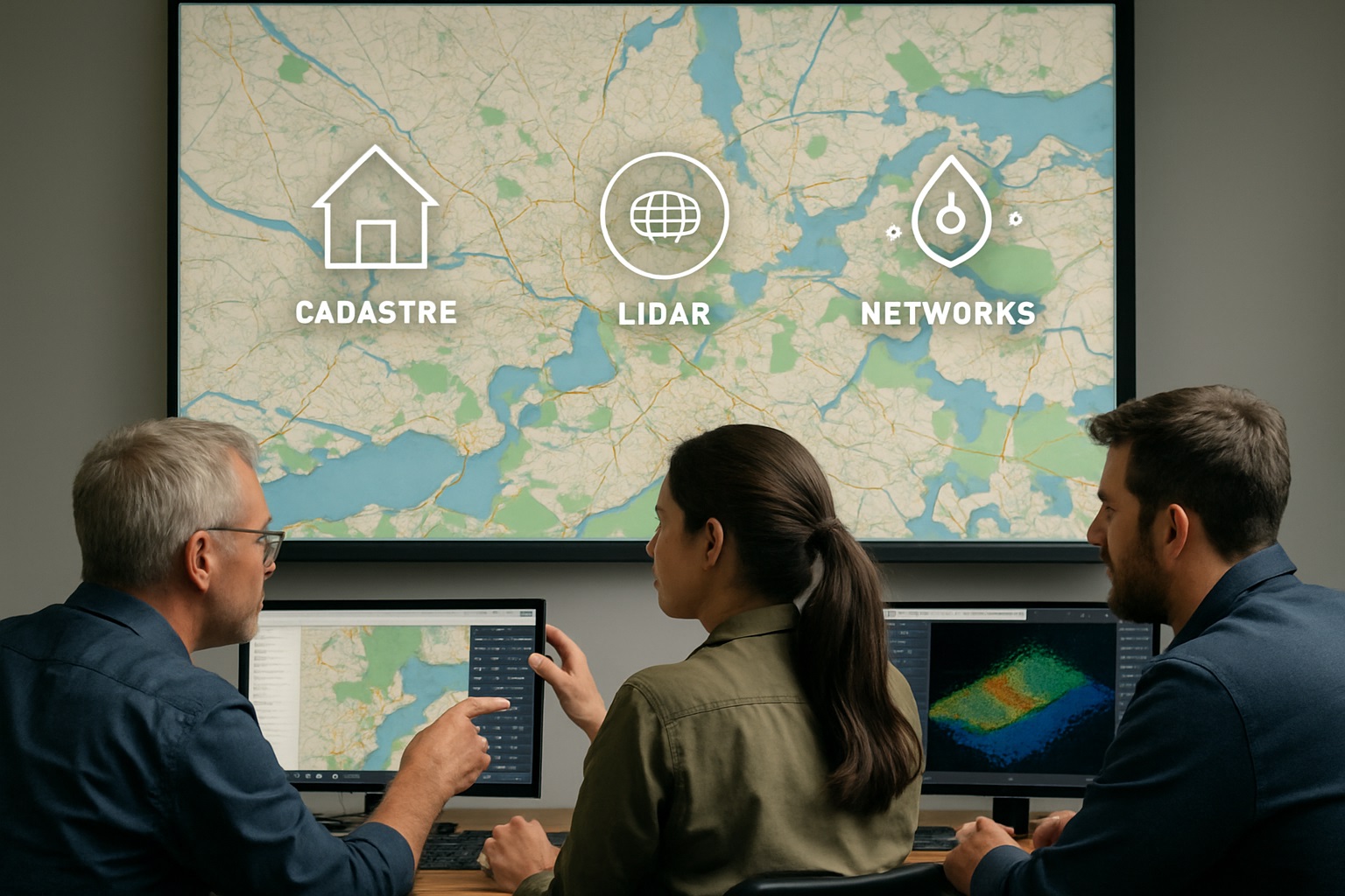
Ipsilum streamlines the capture, management, and publication of territorial data across wide geographic areas.
🗺️ From scattered data to structured knowledge
Local, regional and national governments, businesses, and universities work with territorial data that must be captured and kept up to date — often covering wide areas and following predefined generation standards.
Cartographic, cadastral, or hydrological management still relies heavily on manual processes and bulky tools.
✅ What does Ipsilum solve?
– Automates the processing, refinement, and publication of geospatial data
– Centralizes all types of territorial information in a unified environment
– Facilitates the creation of cartographic products
– Enables agile, visual management of urban inventories, hydrography, flood zones, utility networks, and more
💡 Use cases:
– Real-time collaborative urban cadastre
– Publishing and updating cartographic products
– Managing and sharing LiDAR data for 3D territory modeling
– Integrated publication of territorial information
Frequently Asked Questions
Understanding Ipsilum in simple terms.
What is Ipsilum?
Ipsilum is a next-generation geospatial platform designed to assist local, regional and national governments, businesses, and universities to manage, analyze and act on location-based information—without the need for technical expertise or complex tools.
Do I need to install any software to use Ipsilum?
No. Ipsilum is 100% cloud-native. Everything runs directly in your browser—no installations, no updates, no maintenance required.
What kind of data can I use with Ipsilum?
Ipsilum supports a wide range of spatial and non-spatial data:
🗸 GeoJSON, GeoParquet, Shapefiles, COGs, COPCs
🗸 Video, sensor data, real-time feeds (IoT)
🗸 Databases and open data APIs
You can also combine different sources in a single workflow.
Is Ipsilum only for geospatial experts?
Absolutely not. One of our main goals is to make powerful spatial technologies accessible to everyone—planners, emergency teams, infrastructure managers, public agencies and beyond.
Can I interact with users or field teams through Ipsilum?
Yes. Ipsilum allows two-way communication, letting you receive geolocated feedback, alerts or reports from users or remote workers in the field—and to act on them in real time.
What makes Ipsilum different from a traditional GIS?
Ipsilum is:
🗸 Cloud-based and scalable
🗸 Modular and adaptable to any sector
🗸 Serverless-capable, enabling in-browser processing
🗸 Designed for both experts and non-experts
🗸 Focused on real-world coordination and decision-making
Can I test the platform before committing?
Of course. You can request a free trial or schedule a personalized demo with our team. Contact
Team
Behind every great platform is a brilliant team — our multidisciplinary experts are the driving force that turns technology into real-world impact.

José Santiso
Founder & Chief Executive Officer
Nuria Serrano
Co-Founder
José Antonio Rubio
CBDO
Alejandro Perugorria
LATAM Account Manager
Rolando Robles
Peru Account Manager
Peter Jordan
Advisor
Gregory Gorman
Advisor
Jose Luis de Lope
AdvisorContact
We would love to hear from you.
Whether you are looking for a partnership, a world-class geospatial solution, or simply want to learn more about us, our team is here to help.
Address
Gobelas 25-27 Street, 28023 Madrid, Spain
Call Us
+34 911160606
Email Us
info@ipsilum.com