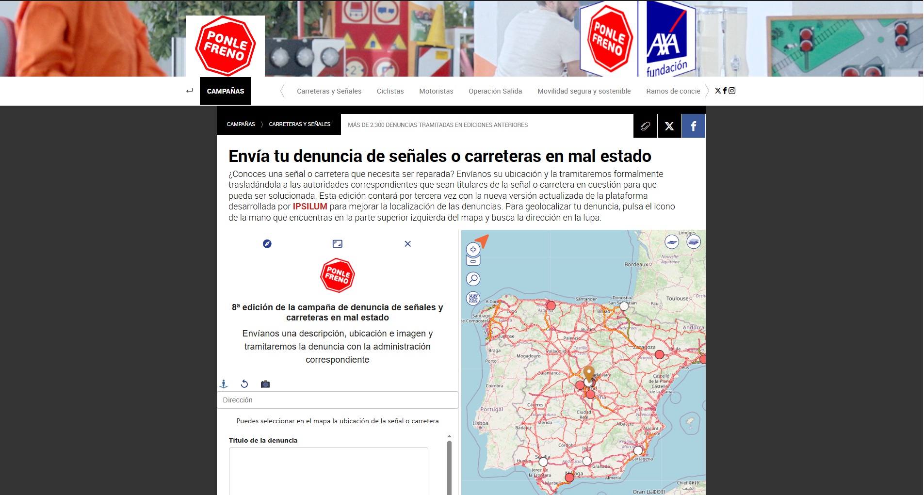
Blog

Real-Time Geospatial Intelligence from Your Browser: Isochrones with a Click using Ipsilum

In the world of Location Intelligence, time is more than just a variable — it's the new axis for decisions in mobility, logistics, emergency services, retail and public planning. In this article, we explore how Ipsilum reinvents geospatial analysis with its serverless, cloud-native, browser-first architecture — enabling instant isochrone analysis with a single click.

Serverless Processing in the Browser: A New Way to Analyze Geospatial Data Without Complexity

Technical post. This series explains how we manage information and processes in Ipsilum in a way that’s accessible for non-expert users. Our goal is to make life easier for people who don’t need to know what Jupyter is—or how a geospatial database works. We want them to be able to run advanced analytics with the same ease as checking a map or filling out a form. That simple. That powerful.

Geospatial + Big Data: when analysis stops being just a map and becomes real-time intelligence.

We are witnessing a turning point in how geospatial information is managed and used. Traditional models—built around static systems, local servers, and isolated datasets—are rapidly becoming obsolete. The future lies in browser-based computation, cloud-native architectures, real-time data fusion, and edge-based intelligence, even in disconnected environments.

How the way we access and analyze data is radically changing

We are witnessing a fundamental shift in how geospatial information is managed and used. Traditional models - based on static systems, local servers, and isolated files - are no longer sufficient. The future lies in browser-based computation, cloud-native architectures, real-time data fusion, and edge-based intelligence, even offline. Organizations across civil, emergency, and security domains need more than visualizations - they need the ability to act, analyze, and adapt in real time, integrating geospatial context into every decision.
Today’s transformation is driven by a few key principles: